The Process of CALPUFF Modeling
The following guest post covers essential information and a brief process of the CALPUFF modeling.
 latestfeeds
Share this Post to earn Money ( Upto ₹100 per 1000 Views )
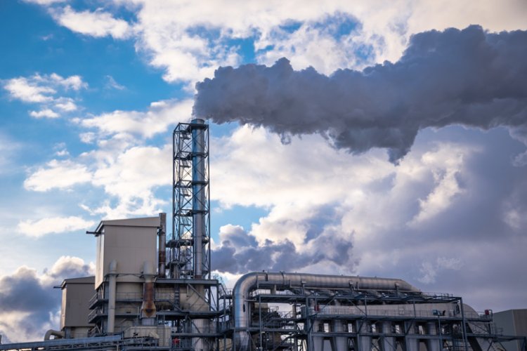
CALPUFF is a complex air quality modeling system designed to predict the dispersion of ash ambient air pollutants over both distance and difficult terrain. The U.S. Environmental Protection Agency (EPA) developed CALPUFF to run a wide variety of processes for environmental dispute, use control, and air quality management.
Overview of CALPUFF
CALPUFF modeling is designed to model the dispersion of pollutants from many sources, including point sources area sources and volume sources. It accounts for complex meteorological conditions and terrain variations, making it suitable for assessing air quality in various environments.
Components of CALPUFF
- CALMET: This meteorological preprocessor makes the meteorological input data for CALPUFF. It uses observational data and incorporates terrain effects to generate a three-dimensional meteorological field.
- CALPUFF: The core dispersion model, CALPUFF simulates the transport, dispersion, and deposition of pollutants. It handles both continuous and episodic emissions and can model various chemical transformations and removal processes.
- CALPOST: This post-processor calculates pollutant concentrations and deposition rates based on the output from CALPUFF. It generates output files that can be used for further analysis and interpretation.
Steps in the CALPUFF Modeling Process
1. Defining the Modeling Domain
The first step in CALPUFF modeling involves defining the geographic area to be modeled. This includes:
- Model Domain: Establish the spatial extent of the study area, including the location of emission sources, receptors, and boundaries.
- Grid Configuration: Set up the grid structure for the model domain, specifying the computational grid's resolution and coverage.
2. Preparing Meteorological Data
Meteorological data are crucial for accurate dispersion modeling. The CALMET preprocessor handles this step by:
- Data Collection: Gather meteorological data from weather stations, satellites, and numerical weather prediction models.
- Data Processing: Applying quality control and preprocessing procedures to ensure the accuracy and consistency of the data.
- Terrain and Land Use: Incorporating terrain data and land use information to account for local variations in meteorological conditions.
3. Configuring the Emission Sources
Define the emission sources in the Calpuff Modeling Chicago, including:
- Source Types: Identify the type of sources (point, area, volume) and their specific characteristics.
- Emission Rates: Input emission rates for each source, considering factors like production rates and operational conditions.
- Source Locations: Specify the geographic locations of the sources within the model domain.
4. Setting Up the CALPUFF Model
Configure the CALPUFF model by:
- Input Parameters: Enter parameters related to pollutant dispersion, such as stack height, plume rise, and chemical reactions.
- Model Options: Choose options for modeling features like complex terrain, variable meteorological conditions, and chemical transformations.
- Simulation Period: Define the simulation period, including start and end dates, and time intervals.
5. Running the CALPUFF Model
Execute the CALPUFF model to simulate pollutant dispersion:
- Initialization: Load the meteorological and emission data into the model.
- Simulation: Run the model to compute the dispersion of pollutants based on the input parameters and conditions.
- Monitoring: Monitor the model run to ensure it completes successfully and produces valid results.
6. Post-Processing and Analysis
After running the CALPUFF model, analyze the results using CALPOST:
- Output Files: Review the output files generated by CALPUFF, which include pollutant concentrations, deposition rates, and other relevant metrics.
- Data Interpretation: Interpret the results to assess air quality impacts, compare with regulatory standards, and identify potential issues.
- Reporting: Prepare reports summarizing the findings, including graphical representations and statistical analyses.
7. Model Calibration and Validation
To ensure the accuracy and reliability of CALPUFF results, model calibration and validation are crucial:
- Calibration: Adjust model parameters and configurations to match observed data from monitoring stations. This process helps refine the model’s accuracy in representing local conditions.
- Validation: Compare model predictions with independent observational data that were not used during calibration. This step verifies that the model performs well under different conditions.
8. Uncertainty Analysis
Understanding the uncertainty in model predictions is important for risk assessment and decision-making:
- Input Uncertainty: Evaluate the impact of uncertainties in meteorological, emission, and terrain data on model results.
- Sensitivity Analysis: Determine how changes in model parameters affect the outcomes, helping to identify which parameters have the most influence on predictions.
9. Temporal and Spatial Resolution
The choice of temporal and spatial resolution affects the model’s accuracy and computational efficiency:
- Temporal Resolution: Decide on the time intervals for meteorological data and simulation periods (e.g., hourly, daily). Finer temporal resolution provides more detailed results but requires more data and computational resources.
- Spatial Resolution: Determine the grid size for the model domain. Smaller grid sizes offer more detailed spatial information but increase computational demand.
10. Chemical Transformation and Deposition
CALPUFF can model chemical transformations and pollutant deposition, which are essential for accurate assessments:
- Chemical Reactions: Include processes such as oxidation, reduction, and photochemical reactions that affect pollutant concentration and composition.
- Deposition Mechanisms: Account for dry deposition (e.g., deposition on surfaces) and wet deposition (e.g., through precipitation) to model the removal of pollutants from the atmosphere.
11. Modeling Complex Terrain
Handling complex terrain is one of CALPUFF’s strengths, and it involves:
- Topographic Effects: Incorporate detailed terrain data to account for variations in elevation and slope, which can influence pollutant dispersion patterns.
- Flow Patterns: Model how terrain features like mountains and valleys affect wind flow and pollutant dispersion.
Applications of CALPUFF Modeling
Calpuff Modeling Los Angeles is used in various applications, including:
- Regulatory Compliance: Ensuring that industrial activities comply with air quality standards and regulations.
- Environmental Impact Assessments: Evaluating the potential impact of new projects or changes in land use on air quality.
- Permit Applications: Supporting permit applications by providing evidence of compliance with air quality requirements.
- Emergency Response: Assessing the dispersion of pollutants in case of accidental releases or emergencies.
Challenges and Considerations
Despite its capabilities, CALPUFF modeling has certain challenges:
- Data Quality: Accurate meteorological and emission data are crucial for reliable results. Poor data quality can lead to erroneous predictions.
- Model Complexity: CALPUFF is complex and requires expertise to configure and interpret. Proper training and experience are essential for effective use.
- Computational Resources: Running CALPUFF simulations, especially for large domains or long time periods, can be computationally intensive.
Conclusion
CALPUFF is a powerful tool for modeling air pollutant dispersion in complex environments. Its ability to account for varying meteorological conditions and terrain features makes it invaluable for environmental assessments and regulatory compliance. By following a structured process—from defining the modeling domain to analyzing results—users can effectively leverage CALPUFF to understand and manage air quality impacts.