
The Future of Aerial Security: Exploring Top Drone Survey Software and Surveillance Drones
 Sharavani Singh
Share this Post to earn Money ( Upto ₹100 per 1000 Views )
The realm of security and surveying is rapidly evolving, and at the heart of this transformation are two powerful technologies: drone survey software and surveillance drones. What was once the domain of satellites and manned helicopters has now become accessible, efficient, and intelligent through advancements in unmanned aerial vehicles (UAVs) and sophisticated data analysis tools.
In 2025, these innovations will play a critical role in sectors such as infrastructure inspection, border control, emergency response, and private security. Their speed, versatility, and data accuracy are helping organizations enhance safety, streamline operations, and gain situational awareness like never before.
Understanding Surveillance Drones: The Eyes in the Sky
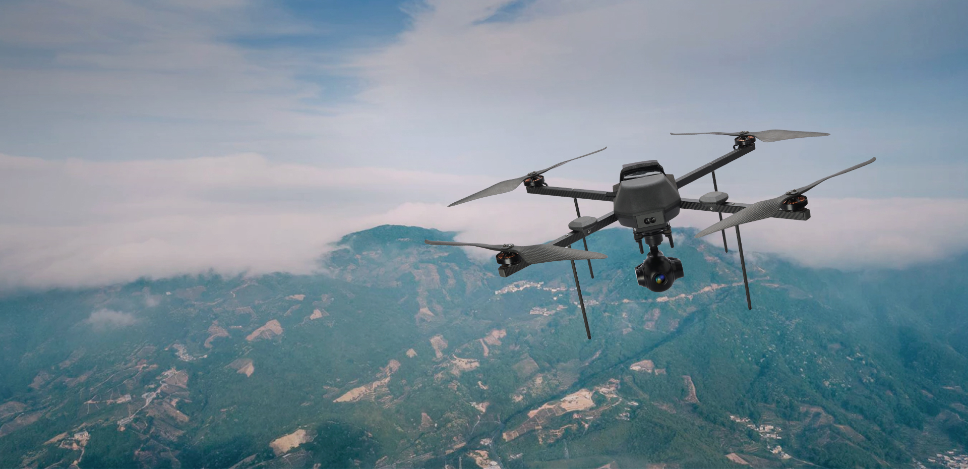
A surveillance drone is an unmanned aerial vehicle equipped with high-resolution cameras, thermal sensors, LiDAR, and other sensing technologies. These drones are designed to capture real-time visuals and data from elevated vantage points, making them invaluable for monitoring activities, detecting threats, and supporting tactical operations.
Key Features of Surveillance Drones:
HD and thermal imaging for day and night operations
Live video transmission with low latency
Long-range flight capabilities with GPS and geofencing
AI-driven threat detection and object tracking
Stealth mode for discreet operations
Surveillance drones are now widely used by law enforcement agencies, critical infrastructure providers, wildlife protection units, and private security firms. Their ability to cover vast areas quickly, without human risk, has revolutionized aerial monitoring.
The Power of Drone Survey Software
While surveillance drones provide the hardware backbone, it is drone survey software that extracts value from the data they collect. This specialized software converts raw aerial footage and sensor readings into usable formats such as 2D orthomosaic maps, 3D terrain models, and geospatial reports.
Capabilities of Drone Survey Software:
Geotagging and spatial analytics for accurate location tracking
Automated flight path planning for consistent coverage
Real-time data streaming and post-processing
Integration with GIS platforms and cloud storage
Advanced AI and machine learning for predictive analysis
Together, drone survey software and surveillance drones provide a complete aerial intelligence ecosystem. They not only see the environment, they understand it.
Real-World Applications: Security and Beyond
The convergence of drone survey software and surveillance drone technology has opened doors to multiple applications across industries. Here are some key sectors where these tools are making a tangible impact:
Critical Infrastructure Monitoring
Power grids, oil pipelines, and transportation networks require constant surveillance. Drones can patrol long distances, detect anomalies, and send alerts in real-time. The mapping software allows for precise documentation and changes detection over time.
Border and Coastal Surveillance
In regions where the terrain is rugged or visibility is limited, drones offer round-the-clock monitoring. With thermal sensors and night-vision capabilities, surveillance drones help detect unauthorized movement or breaches.
Disaster Response and Search & Rescue
After earthquakes, floods, or wildfires, drones can quickly scan affected areas, identify survivors, and map damage. Survey software enables emergency teams to plan safe routes and deploy resources efficiently.
Urban Law Enforcement
Police departments are deploying drones to monitor public events, protests, or high-crime neighbourhoods. AI-driven features in modern drone survey software can detect suspicious activity and even assist in facial recognition and vehicle tracking.
Private Security and Asset Protection
High-value properties, warehouses, and industrial parks can be continuously monitored using autonomous surveillance drones. The data collected is analyzed using survey software to detect irregularities or unauthorized access.
,aspect=fit)
Top Drone Survey Software Platforms in 2025
As drone technology becomes more accessible, the market for survey software is growing. Below are some of the leading platforms known for their performance, features, and reliability:
Asteria Aerospace’s Aerial Intelligence Suite
Asteria Aerospace provides an integrated suite that combines both surveillance drone hardware and advanced drone survey software capabilities. Their software supports automated flight missions, AI-based image analytics, and centralized data management—all tailored for security, surveying, and public safety operations.
DroneDeploy
Popular for its ease of use and cloud-based features, DroneDeploy supports mapping, 3D modeling, and real-time collaboration. Its applications span from agriculture to industrial inspection and security.
Pix4Dreact
Designed for emergency response, Pix4Dreact allows quick mapping in disaster-hit zones. It's optimized for creating 2D maps and reports even without internet access, making it a powerful tool in crises.
DJI Terra
Developed by DJI, this software provides comprehensive mapping, 3D reconstructions, and flight planning capabilities. It integrates well with DJI drones, which are widely used in security applications.
Propeller Aero
This platform is tailored for surveying large industrial sites, offering accurate terrain data and analytics. It's ideal for infrastructure security, mining, and logistics.
Challenges and the Road Ahead
Despite the significant progress, a few challenges still need to be addressed to fully harness the potential of these technologies:
Data Security: The vast amount of surveillance data collected must be protected from unauthorized access.
Regulatory Compliance: Drone flights are subject to airspace laws and permissions that vary by country.
Public Perception: The ethical implications of aerial surveillance, especially in urban areas, must be managed with transparency and accountability.
Looking ahead, the integration of technologies like 5G, AI, edge computing, and blockchain will enhance the capabilities of both drone hardware and survey software. Autonomous drone fleets, real-time AI-driven threat detection, and decentralized data storage are just a few of the trends on the horizon.
Conclusion
As the demand for real-time, intelligent surveillance and mapping continues to rise, the combination of drone survey software and surveillance drone technology is proving indispensable. From monitoring borders to responding to emergencies, these tools are redefining how we see and secure the world from above.
Asteria Aerospace, a pioneer in drone innovation, is at the forefront of this transformation. With a comprehensive range of surveillance drones and cutting-edge drone survey software, Asteria empowers governments, enterprises, and security forces to operate smarter, safer, and faster. Their solutions stand as a benchmark for reliability, performance, and technological excellence in the evolving world of aerial security.